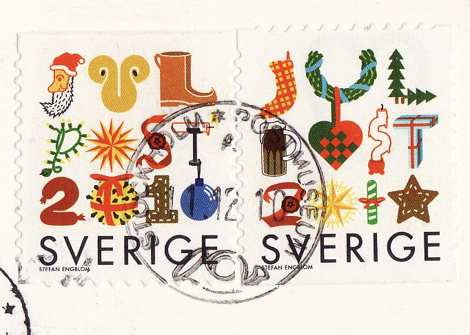
A very cool birthday suprise card from dear Adobe :) It was in my wislist and Carol sent this to me.Thank you very much. I LOVE IT :) .
Native Americans used symbols to communicate their thoughts ,expressions and beliefs.Each symbol has distinctive characteristics and is a unique representation of a sentence,situation or incident.Many of these symbols are incorporated in craft and jewelry desings.
Sunday, 17 June 2012
Kenya
Kenya is a country in East Africa,that lies on equator. With the Indian Ocean to its south-east, it is bordered by Tanzania to the south, Uganda to the west, South Sudan to the north-west, Ethiopia to the north and Somalia to the north-east. Kenya has a land area of 580,000 km2 and a population of nearly 41 million,representing 42 different peoples and cultures. The country is named after Mount Kenya, a significant landmark and second among Africa´s highest mountain peaks. Kenya's capital and largest city is Nairobi.
Kenya has a warm and humid climate along its coastline on the Indian Ocean, which changes to wildlife-rich savannah grasslands moving inland towards the capital. Nairobi has a cool climate that gets colder approaching Mount Kenya, which has three permanently snow-capped peaks. The warm and humid tropical climate reappears further inland towards lake Victoria, before giving way to temperate forested and hilly areas in the western region. The North Eastern regions along the border with Somalia and Ethiopia are arid and semi-arid areas with near-desert landscapes. Lake Victoria, the world's second largest fresh-water lake (after Lake Superior in the US and Canada) and the world's largesttropical lake, is situated to the southwest and is shared with Uganda and Tanzania. Kenya is famous for its safaris and diverse world-famous wildlife reserves such as Tsavo National Park, the Maasai Mara, Nakuru National Park, and Aberdares National Park .
Kristinehamn, Sweden
Kristinehamn is situated by the shores of lake Vänern. To be precise, it is situated where the small rivers Varnan and Löt drain into the lake.
It has a harbour and is a railroad and road transportation center.
Nearby towns include Karlskoga and Karlstad and is located exactly in the middle of Oslo , Stockholm and Gothenburg with 250 km to each of them.
By the shores of lake Vänern stands this 15 meter high Pablo Picasso statue since 1965. The statue was concipated from Picasso, but built and inaugurated without him visiting the construction site. Picasso never visited Kristinehamn. Its 15 meters make it the tallest Picasso Sculpture in the world.You can see the statue on card aslo.
It has a harbour and is a railroad and road transportation center.
Nearby towns include Karlskoga and Karlstad and is located exactly in the middle of Oslo , Stockholm and Gothenburg with 250 km to each of them.
By the shores of lake Vänern stands this 15 meter high Pablo Picasso statue since 1965. The statue was concipated from Picasso, but built and inaugurated without him visiting the construction site. Picasso never visited Kristinehamn. Its 15 meters make it the tallest Picasso Sculpture in the world.You can see the statue on card aslo.
Öland , Swden
It has been almost a year without new posts :S .
It is time to show a new card.This time it is from my Sweden cards.This card shows Öland. Öland is the second largest Swedish island.and the smallest of the traditional provinces of Sweden. Öland has an area of 1,342 km² and is located in the Baltic Sea just off the coast of Småland. The island has 25,000 inhabitants, but during Swedish Midsummer it is visited by up to 500,000 people.It is separated from the mainland by the Kalmar stait and connected to it by the 6 km Öland bridge, which opened in 1972.
Friday, 9 September 2011
Jip and Janneke
Meeting card from Rotterdam :)
Signed by Jetske,Octabis,Dandillion,MissMaple,Cindy79,Tijtske and Laura ;) Thank you very much ,you all made my day :)
Jip and Janneke (Dutch: Jip en Janneke) is a series of children's books in the Netherlands, written by Annie M.G. Schmidt and illustrated by Fiep Westendorp. The series is known for its simplicity and wit.
Signed by Jetske,Octabis,Dandillion,MissMaple,Cindy79,Tijtske and Laura ;) Thank you very much ,you all made my day :)
Jip and Janneke (Dutch: Jip en Janneke) is a series of children's books in the Netherlands, written by Annie M.G. Schmidt and illustrated by Fiep Westendorp. The series is known for its simplicity and wit.
From Russia with love
Wonderful map card from Pal :) .Thank you very much.
Founded in the 12th century, the Principality of Muscovy, was able to emerge from over 200 years of Mongol domination (13th-15th centuries) and to gradually conquer and absorb surrounding principalities. In the early 17th century, a new Romanov Dynasty continued this policy of expansion across Siberia to the Pacific. Under PETER I (ruled 1682-1725), hegemony was extended to the Baltic Sea and the country was renamed the Russian Empire. During the 19th century, more territorial acquisitions were made in Europe and Asia. Defeat in the Russo-Japanese War of 1904-05 contributed to the Revolution of 1905, which resulted in the formation of a parliament and other reforms. Repeated devastating defeats of the Russian army in World War I led to widespread rioting in the major cities of the Russian Empire and to the overthrow in 1917 of the imperial household. The Communists under Vladimir LENIN seized power soon after and formed the USSR. The brutal rule of Iosif STALIN (1928-53) strengthened Communist rule and Russian dominance of the Soviet Union at a cost of tens of millions of lives. The Soviet economy and society stagnated in the following decades until General Secretary Mikhail GORBACHEV (1985-91) introduced glasnost (openness) and perestroika (restructuring) in an attempt to modernize Communism, but his initiatives inadvertently released forces that by December 1991 splintered the USSR into Russia and 14 other independent republics. Since then, Russia has shifted its post-Soviet democratic ambitions in favor of a centralized semi-authoritarian state whose legitimacy is buttressed, in part, by carefully managed national elections, former President PUTIN's genuine popularity, and the prudent management of Russia's windfall energy wealth. Russia has severely disabled a Chechen rebel movement, although violence still occurs throughout the North Caucasus.
My roots are also in Russia ,my dad is near from Yekaterinburg . Russia is worth visiting and russian people are kind :)
Sunday, 19 December 2010
Lake Baikal

Wonderful Unesco card from Siberia(it is very special to me ,my dad was born in Siberia)
We visited Siberia in 1990 or 1991 ..I guess.I remeber it was really hot but I loved it.
Lake Baikal is the world's oldest and deepest lake; it is the second most voluminous lake, after the Caspian Sea. As the most voluminous freshwater lake in the world, with an average depth of 744.4 m (2,442 ft), Lake Baikal contains roughly 20% of the world's surface fresh water, and is located in the south of the Russian region of Siberia (between Irkutsk Oblast to the northwest and the Buryat Republic to the southeast, near the city of Irkutsk).
At 1,642 metres (5,387 ft), Lake Baikal is the deepest, and among the clearest of all lakes in the world. At more than 25 million years old, Baikal is also the world's oldest lake. Like Lake Tanganyika, Lake Baikal was formed as an ancient rift valley, having the typical long crescent shape with a surface area of 31,722 km2/12,248 sq mi, less than that of Lake Superior or Lake Victoria. Baikal is home to more than 1,700 species of plants and animals, two thirds of which can be found nowhere else in the world and was declared a UNESCO World Heritage Site in 1996. It is also home to Buryat tribes who reside on the eastern side of Lake Baikal, rearing goats, camels, cattle and sheep, where the regional temperature varies from a minimum of −19 °C (−2 °F) in winter to maximum of 14 °C (57 °F) in summer.
Isle of Man

Beautiful card from Ria (from our private swap),sent from USA .
The Isle of Man , otherwise known simply as Mann , is a self-governing British Crown Dependency, located in the Irish Sea between the islands of Great Britain and Ireland, within the British Isles. The head of state is Queen Elizabeth II, who holds the title of Lord of Mann. The Lord of Mann is represented by a Lieutenant Governor. The island is not part of the United Kingdom, but its foreign relations and defence are the responsibility of the UK Government. Although it does not usually interfere in the island's domestic matters, its "good government" is ultimately the responsibility of the Crown (i.e., in practice, the Government of the United Kingdom).
The island has been inhabited since before 6500 BC. It began to be influenced by Gaelic culture in the AD 5th century and the Manx language, a branch of the Gaelic languages, gradually emerged. In the 9th century, the Norse began to settle there. A Norse-Gaelic culture emerged and the island came under Norse control. In 1266, the island became part of Scotland. After a period of alternating rule by the kings of Scotland and England, the island came under the feudal overlordship of the English Crown in 1399. The lordship revested into the British Crown in 1764 but the island never became part of the United Kingdom and retained its status as an internally self-governing jurisdiction.
The island is not a member of the European Union, but has a limited relationship concerning the free movement of goods.
The island has been inhabited since before 6500 BC. It began to be influenced by Gaelic culture in the AD 5th century and the Manx language, a branch of the Gaelic languages, gradually emerged. In the 9th century, the Norse began to settle there. A Norse-Gaelic culture emerged and the island came under Norse control. In 1266, the island became part of Scotland. After a period of alternating rule by the kings of Scotland and England, the island came under the feudal overlordship of the English Crown in 1399. The lordship revested into the British Crown in 1764 but the island never became part of the United Kingdom and retained its status as an internally self-governing jurisdiction.
The island is not a member of the European Union, but has a limited relationship concerning the free movement of goods.
Subscribe to:
Posts (Atom)